Flood alerts for Wakefield removed - but Castleford and Pontefract remain on high alert as danger from Storm Christoph remains
and live on Freeview channel 276
Flood alerts, and more serious flood warnings, have been in place for large parts of the Wakefield district this week, after Storm Christoph led to heavy rainfall and high river levels.
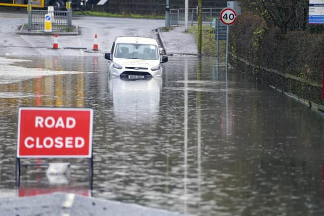
Photos taken across the district show the extent of flooding on a number of lower roads and fields.
Advertisement
Hide AdAdvertisement
Hide AdBut flood alerts in place for Wakefield and Horbury, including Horbury Bridge, Normanton and Stanley, have now been removed.

Updating the flood warning for the lower River Calder catchment, the Environment Agency said: "This Flood Alert has been removed as river levels have now fallen below the flood risk threshold.
"River levels on the Lower Calder have continued to fall overnight and there is no longer a threat of further flooding, though standing water and debris may still remain on low-lying land.
"No further significant rainfall is forecast in the next 24 hours and levels are expected to continue to fall."
Advertisement
Hide AdAdvertisement
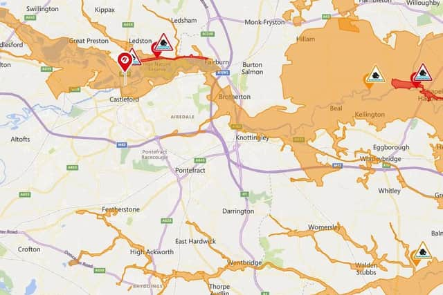
Hide AdHowever, flood alerts remains in place for large areas of Castleford, Fairburn and Allerton Bywater, as well as Knottingley and Brotherton and some areas of Featherstone, Hemsworth and Ackworth.
A flood alert means that flooding is possible, and those living in the affected area are encouraged to keep a bag packed with essentials such as medication and insurance documents.
A more severe flood warning, meaning flooding is expected soon, remains in place for Allerton Ings and Barnsdale Road.
The warning reads: "River levels remain elevated as a result of the heavy and persistent rainfall associated with Storm Christoph. The spillway at Allerton Ings has stopped operating with the washlands starting to drain.
Advertisement
Hide AdAdvertisement
Hide Ad"Barnsdale Road has flooded and remains closed. We are closely monitoring the situation.
"Please avoid using low-lying footpaths and roads near watercourses, and plan driving routes to avoid low-lying land that may be flooded."